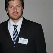
Dr. Ori Gudes
Details
-
Department: School of GUSS
-
Campus: City Campus Australia
-
ori.gudes@rmit.edu.au
-
ORCID: 0000-0002-2102-885X
About
Dr. Ori Gudes - Enhancing Urban Liveability through Spatial Analysis
Background and Focus With a strong background in 🗺️ geospatial science and 🏙️ urban planning, Dr. Ori Gudes focuses his research on spatial data analysis to enhance urban 🌿 liveability, improve health outcomes, and support evidence-based decision-making in urban planning.
Key Projects and Contributions Through projects such as the Australian Urban Observatory and initiatives in transport and health, Dr. Gudes has been involved in developing spatial indicators to better understand how the built environment impacts community well-being as well as led the development of the Urban Scorecards. His work involves analysing access to public transport, 🌳 greenspace visibility, 🚴♂️ active transport options, and 🚶♂️ urban walkability to inform policy and improve urban environments.
Data Visualization and Policy Impact Dr. Gudes is dedicated to integrating user-friendly 📊 data visualization tools, such as automated scorecards, to make spatial insights accessible to policymakers. These tools are designed to enhance evidence-based planning by delivering actionable urban indicators in a clear and effective manner.
Research fields
- 4206 Public health
- 4203 Health services and systems
- 3304 Urban and regional planning
- 3709 Physical geography and environmental geoscience
- 4013 Geomatic engineering
- 3301 Architecture
- 4202 Epidemiology
- 3509 Transportation, logistics and supply chains
- 4406 Human geography
- 4601 Applied computing
Teaching interests
- A new online GIS for Public Health course: https://www.udemy.com/user/gis4ph/
- City Building: Transport and Infrastructure (T2 , 2021)
- City Building: Transport and Infrastructure (T1 & T3, 2020)
- Data visualization workshops, CRCDH (2020)
- GIS and Urban Informatics, UNSW, NSW, Australia (2018-2019)
- Research seminar (2019)
- Smart Cities Major Project course (2019)
- Transportation planning (2019)
- Web Mapping, Curtin University, WA, Australia (2014-2016)
- GIS workshops for beginners, Griffith University (2010-2017)
- Introduction to GIS, Curtin University, WA, Australia (2014-2016)
- Basics of GIS , QUT, Queensland, Australia (2008-2013)
Supervision of PhD and Master's Students Dr. Ori Gudes has successfully co-supervised two Ph.D. students to completion at Griffith University: Mark Runkowski (with distinction) and Agustina Barros. He also supervised Cristina Dias, a master's student at Curtin University, whose thesis was titled A Crowdsourced Web Mapping Application for Street Art in Perth. Additionally, Dr. Gudes has supervised six master's students as part of the Master of City Analytics program.
Past PhD Students
- Kazi Mohammad Zillur Rahman (Scientia PhD Student, UNSW): Kazi's research, titled Wastewater Indicators of Antibiotic Resistance in the Community, focused on establishing trends in antimicrobial resistance using sewage wastewater. Dr. Gudes supported the development of a model that spatially mapped antibiotic resistance across NSW.
- Parisa Zare (PhD Student): Parisa's research, Built Environment: The Key Element in Choosing to Cycle in Cities, explored how specific characteristics of the built environment influenced cycling behaviour. The project also examined the economic benefits of cycling in health and socio-economic contexts.
- Weijia Liu (PhD Student, UNSW): Weijia's research, Wastewater Surveillance for Monitoring Trends of Antibiotic Use and Resistance, aimed to develop a novel wastewater epidemiology approach to track antibiotic usage. Dr. Gudes assisted in visualizing antibiotic consumption across Sydney in collaboration with Sydney Water and the University of Queensland.
- Roula Zougheib (PhD Student): Roula's research focused on assessing the impact of the COVID-19 pandemic on children's outdoor active mobility. Utilizing GIS and statistical tools, the research aimed to inform health interventions by identifying vulnerable children at risk during health crises.
Research interests
Research Interests Dr. Gudes' research focuses on geospatial technology to improve urban environments and health. He develops spatial indicators, urban scorecards and explores active transport trends, and greenspace planning, and uses data visualization techniques to empower policymakers.